
Our experts have created an information hub to help practitioners and policy makers during the COVID-19 public health crisis. The Coronavirus Data Hub includes several dashboards, data, and maps about Indiana’s situation. We will continue to add new information, so check back often. On the Hub you will find:
- Central Indiana Neighborhood-Level Risk Estimates is a model showing which Central Indiana neighborhoods are at higher risk of severe and deadly cases, based on demographic data and health estimates. “Using demographic data from the U.S. Census Bureau and estimates of neighborhood health data from the CDC’s 500 Cities Project, we can estimate areas with high-risk populations. We can use statistics to simplify and synthesize the information. We found there are two distinct groups of indicators that relate to risk populations. One group relates to socioeconomic status and one group relates to age,” says Matt Nowlin, Information Designer.
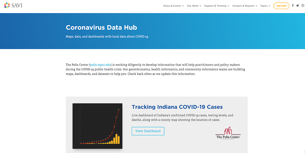
- Tracking Indiana COVID-19 Cases provides the latest statistics for Indiana, along with data from the Census and Indiana Dept. of Health showing at-risk populations.
- Indiana County-Level Cases and Risks tracks general Indiana information. “The COVID-19 case information outside Indiana comes from Johns Hopkins University (the site pretty much everyone on the planet references). The Indiana case information comes straight from ISDH. These two datasets are automatically updated by their respective authors,” says Marianne Cardwell, GIS Project coordinator. The source data is hosted on Google Sheets if you are interested.