Amid Climate Change Extremes, Polis Center Experts Help Indiana Counties Be More Natural Disaster Resilient
With climate change concerns and the impact of extreme weather conditions on communities, it is important that Indiana residents know that work is constantly ongoing throughout the state to minimize future damage and loss. The Polis Center at IUPUI—a leader in the disaster resiliency industry nationally—is involved in this effort in a major way, working closely with many Indiana counties, the Indiana Department of Homeland Security (IDHS), the Indiana Department of Natural Resources (IDNR), and the Federal Emergency Management Agency (FEMA).
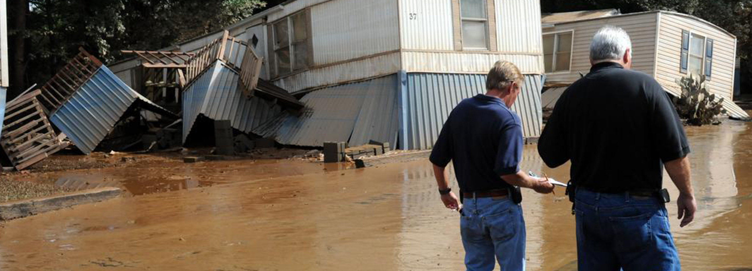
Floods, tornadoes, severe storms, and earthquakes are among the natural hazard risks in Indiana. Flooding has the highest level of risk in the state. Polis calculates that a 100-year flood could damage 57,000 buildings in the state. Damages to these buildings could exceed $5 billion statewide. The Indiana Climate Change Impacts Assessment estimates that from 1895 to 2016, the state has seen an increase in its annual average precipitation from 3.3″ in the northeast portion of the state to almost 7″ in the southern portion of the state. Continued increases in rainfall will lead to additional flooding issues in the future.
Polis is one of two FEMA CTP in Indiana. The CTP distinction is noteworthy because CTP projects support high quality flood risk assessment and protection through its “Risk MAP” program (Mapping, Assessment, and Planning). The partnership allows close work with local, state, and federal policymakers, applying best practices to the mitigation of the social and economic impacts of flood, earthquakes, and other natural disaster hazards. It provides greater awareness of government grant opportunities. By pooling resources, CTPs can stretch public funds further while enabling more efficient floodplain management. It also supports customized approaches to flood hazard identification where unique conditions exist.
Funded by FEMA CTP grants, the center currently is working on multiple projects in partnership with the IDNR to update flood maps for Indiana counties. We are currently working in the Lower Wabash, Lower East Fork White, and Middle Wabash-Busseron.
Projections indicate that Indiana could see an increase in precipitation (6-8%) by mid-century, which will increase flooding risk in communities. There is also a projected increase in extreme temperature events (hot and cold). New research is indicating that the most frequent area of tornado activity nationwide (Tornado Alley, of which Indiana is not a part currently) is starting to shift eastward due to these precipitation and temperature changes. This shift would bring more frequent severe storms and/or tornadoes to the state. In addition, the threat of earthquakes is not confined to southwestern Indiana. The entire state needs to be prepared for an earthquake. The 2024 State Hazard Mitigation Plan update outlines these projections and the possible effects across Indiana.
For more information, contact Danielle Lafever.