
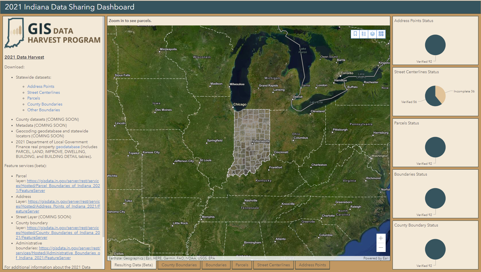
Polis contracted with the State of Indiana for the County Data Harvesting Project in 2021 to manage the integration and improvement of geographic information from all 92 counties. Although the state led the effort since 2008, this was the first time Polis was a key supporter. We are working in partnership with the State GIO and the Indiana Office of Technology.
We coordinated with local data stewards; performed data collection, standardization, quality review, and data augmentation; and helped merge the final data sets into the state’s internal databases. We developed a new statewide geocoder, finalized documentation, and made the data available to the public for download. The project aim is a seamless set of data layers that include land parcels, road centerlines, address points, and local administrative boundaries. The four data layers are very valuable. This resource is used for a variety of applications, such as permitting activities, validating taxing locations, and providing an accurate and detailed base map. It is critical for the successful implementation of Indiana’s next generation 911 system, NG911. The data sets are available here.
The Indiana Geographic Information Council (IGIC) presented the Data Harvest project the 2021 Special Achievement award. This award recognizes special geospatial projects developed through teamwork that demonstrate commitment to working with others in the Indiana GIS community toward a common goal, while performing important, often pioneering work, to create an outstanding information resource.
To learn more, contact Danielle Lafever.